

Characteristics of rockfall trajectory and hazard assessment in western Hubei Province: A case study of the Wapo collapse area in Yuan’an County
-
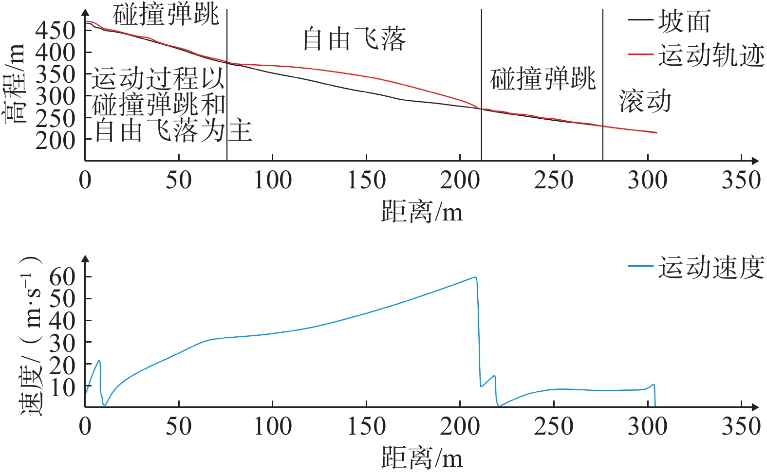
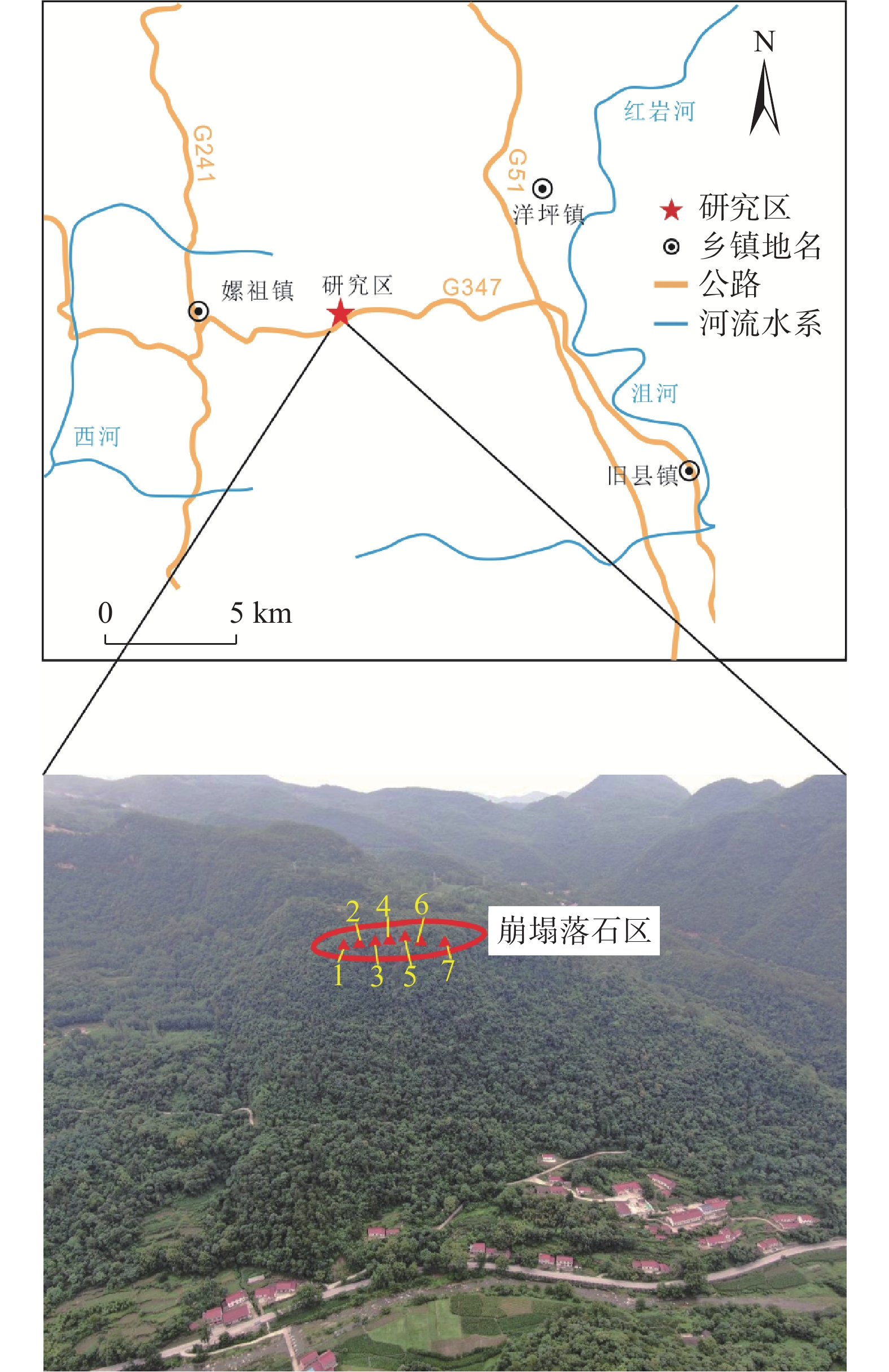
摘要: 以远安县瓦坡崩塌区为例,通过地质调查、野外测绘、无人机航拍,建立了瓦坡崩塌区三维模型,基于Rockfall Analyst(RA)分析软件,实现了瓦坡崩塌区大量崩塌落石三维空间下运动路径、高度、能量等要素模拟,探究了崩塌区落石的三维运动特征,开展了崩塌区落石危险性评估,为崩塌落石的防治提供科学参考。研究结果表明:崩塌区危岩主要破坏形式为倾倒式,目前处于欠稳定状态;模拟落石三维运动轨迹与已有落石点基本重合,说明此次模拟结果与实际情况较为吻合;落石运动过程中以碰撞弹跳、自由飞落为主,落石主要集中在崩塌区下部冲沟及公路内,部分落石达到居民区,在崩塌落石区下部公路、冲沟及崩塌区右侧危险性较高;崩塌落石防治工程建议采用危石孤石清除+被动防护网,在公路内侧、斜坡下方分别设置5 m高和3 m高抗冲击力2 000 kJ的被动防护网,可有效拦截落石。Abstract: Taking the Wapo collapse area in Yuan’an County as an example, a three-dimensional model was established by drone aerial photography, geological survey and field mapping. Based on Rockfall Analyst (RA) analysis software, a large number of three-dimensional rockfalls in the Wapo collapse area were studied. The motion path, height, energy and other factors in the space were simulated to explore the three-dimensional motion characteristics of rockfalls. The risk assessment of rockfalls in the collapsed area was carried out to guide the prevention and control of the rockfalls. The research results showed that the main failure form of the dangerous rock was the toppling, and it was in an under-stable state at present; the three-dimensional motion trajectory of the simulated rockfall basically coincided with the existing rockfall point which indicating the simulation results were in good agreement with the actual situation; The mode of motion of the rocks were collision, bounce and free fall. Rockfalls were mainly concentrated in the gullies and roads but a few rocks reached residential areas. Therefore, the roads, gullies and the right side of the collapse area were in high risk area; Dangerous rock mass and boulders removal and passive protective nets were adopt as the prevention engineering,two passive protection nets which were 5 m high and 3 m high respectively were set on the inner side of the road and below the slope, and a net with an impact resistance of 2 000 kJ could effectively intercept falling rocks.
-
-
![]()
图 10 设置防护网后落石运动轨迹
Figure 10. Rockfall movement trajectory after setting the protective net
表 1 三维运动轨迹模拟基本参数
Table 1 Basic parameters of three-dimensional motion trajectory simulation
坡面类型 法向恢复
系数切向恢复
系数动摩擦角
/(°)最大落石
质量/kg初速度
/(m·s−1)基岩(植被
发育区)0.37 0.83 30 1000 1 居民生活区 0.3 0.82 25 碎石区 0.25 0.80 20  下载: 导出CSV
-
[1] 黄俊光,张帅. 基于动力有限元法的落石运动轨迹研究[J]. 长江科学院院报,2021,38(11):73 − 79. [HUANG Junguang,ZHANG Shuai. Research on trajectory of rockfall based on dynamic finite element method[J]. Journal of Yangtze River Scientific Research Institute,2021,38(11):73 − 79. (in Chinese with English abstract) DOI: 10.11988/ckyyb.20200720 [2] 叶四桥,陈洪凯,唐红梅. 危岩落石防治技术体系及其特点[J]. 公路,2010,55(7):80 − 85. [YE Siqiao,CHEN Hongkai,TANG Hongmei. Rockfall mitigation techniques and its characteristics[J]. Highway,2010,55(7):80 − 85. (in Chinese with English abstract) [3] 王军义,梁风,彭雄武,等. 基于GIS技术的单体崩塌危险范围评价方法研究[J]. 工程地质学报,2021:1 − 12. [WANG Junyi,LIANG Feng,PENG Xiongwu,et al. Study on the assessment method of single collapse risk range based on GIS technology[J]. Journal of Engineering Geology,2021:1 − 12. (in Chinese with English abstract) [4] 何宇航,裴向军,梁靖,等. 基于Rockfall的危岩体危险范围预测及风险评价:以九寨沟景区悬沟危岩体为例[J]. 中国地质灾害与防治学报,2020,31(4):24 − 33. [HE Yuhang,PEI Xiangjun,LIANG Jing,et al. Risk assessment and range prediction of dangerous rockmass based on rockfall:A case study of the Xuangou collapse[J]. The Chinese Journal of Geological Hazard and Control,2020,31(4):24 − 33. (in Chinese with English abstract) [5] 孙敬辉,石豫川. 重庆甑子岩崩塌落石动力学特征及危险性分区[J]. 中国地质灾害与防治学报,2019,30(3):6 − 11. [SUN Jinghui,SHI Yuchuan. Dynamics and hazard zoning of collapse and rockfall in Zengziyan,Chongqing[J]. The Chinese Journal of Geological Hazard and Control,2019,30(3):6 − 11. (in Chinese with English abstract) [6] 胡厚田. 崩塌与落石[M]. 北京: 中国铁道出版社, 1989 HU Houtian. Collapse and falling rocks [M]. Beijing: China Railway Publishing House, 1989. (in Chinese)
[7] 唐红梅,易朋莹. 危岩落石运动路径研究[J]. 重庆建筑大学学报,2003,25(1):17 − 23. [TANG Hongmei,YI Pengying. Research on dangerous rock movement route[J]. Journal of Chongqing Architecture University,2003,25(1):17 − 23. (in Chinese with English abstract) [8] PALMA B,PARISE M,REICHENBACH P,et al. Rockfall hazard assessment along a road in the Sorrento Peninsula,Campania,southern Italy[J]. Natural Hazards,2012,61(1):187 − 201. DOI: 10.1007/s11069-011-9899-0
[9] LAN H X,MARTIN C D,ZHOU C H,et al. Rockfall hazard analysis using LiDAR and spatial modeling[J]. Geomorphology,2010,118(1/2):213 − 223.
[10] 王学良,张路青,张中俭,等. 石经山藏经洞坡体滚石灾害危险性分析[J]. 岩土力学,2012,33(1):191 − 196. [WANG Xueliang,ZHANG Luqing,ZHANG Zhongjian,et al. Rockfall hazard analysis of slope at sutra caves of Shijing Mountain[J]. Rock and Soil Mechanics,2012,33(1):191 − 196. (in Chinese with English abstract) DOI: 10.3969/j.issn.1000-7598.2012.01.030 [11] CHEN G Q,ZHENG L,ZHANG Y B,et al. Numerical simulation in rockfall analysis:A close comparison of 2-D and 3-D DDA[J]. Rock Mechanics and Rock Engineering,2013,46(3):527 − 541. DOI: 10.1007/s00603-012-0360-9
[12] LAN H X,MARTIN C D,LIM C H. RockFall analyst:A GIS extension for three-dimensional and spatially distributed rockfall hazard modeling[J]. Computers & Geosciences,2007,33(2):262 − 279.
[13] 仉义星,兰恒星,李郎平,等. 综合统计模型和物理模型的地质灾害精细评估:以福建省龙山社区为例[J]. 工程地质学报,2019,27(3):608 − 622. [ZHANG Yixing,LAN Hengxing,LI Langping,et al. Combining statistical model and physical model for refined assessment of geological disaster:A case study of Longshan community in Fujian Province[J]. Journal of Engineering Geology,2019,27(3):608 − 622. (in Chinese with English abstract) [14] 王栋,王剑锋,李天斌,等. 西南山区某铁路隧道口高位落石三维运动特征分析[J]. 地质力学学报,2021,27(1):96 − 104. [WANG Dong,WANG Jianfeng,LI Tianbin,et al. Analysis of three-dimensional movement characteristics of rockfall:A case study at a railway tunnel entrance in the southwestern mountainous area,China[J]. Journal of Geomechanics,2021,27(1):96 − 104. (in Chinese with English abstract) [15] 刘洪江,兰恒星. “5·12”震后都江堰—汶川公路崩塌灾害模拟及危险性评价[J]. 资源科学,2012,34(2):345 − 352. [LIU Hongjiang,LAN Hengxing. Rockfall disaster simulation and risk assessment on the Dujiangyan-Wenchuan highway after “5·12” earthquake[J]. Resources Science,2012,34(2):345 − 352. (in Chinese with English abstract) -
期刊类型引用(10)
1. 陈亮,宋银,杨林,巴净慧,陈典. 德钦县楚巴崩塌特征分析及防治措施研究. 昆明冶金高等专科学校学报. 2024(04): 1-8 .  百度学术
百度学术
2. 邓华锋,骆祚森,张景昱,周美玲,李建林. 库岸边坡消落带水-岩作用研究进展与展望. 三峡大学学报(自然科学版). 2023(05): 95-104 . 百度学术
3. 胡雷,张鹏,黄波林. 三峡库区典型岩溶岸坡危岩体失稳模式和长期稳定性分析. 中国地质灾害与防治学报. 2023(05): 64-73 . 本站查看
4. 胡刘洋,张鹏,黄波林. 三峡库区消落带岩体劣化下危岩体长期变形破坏机理——以冠木岭为例. 工程地质学报. 2023(06): 1891-1900 . 百度学术
5. 赵志男,李滨,贺凯,殷跃平,高杨. 西南山区柱状危岩体基座压裂溃屈断裂力学解析. 岩石力学与工程学报. 2022(S2): 3132-3140 . 百度学术
6. 王林峰,程平,夏万春,唐宁. 化学及干湿循环作用下泥灰岩损伤劣化特性分析. 防灾减灾工程学报. 2022(05): 976-985 . 百度学术
7. 黄波林,殷跃平,李滨,白林丰,秦臻. 柱状危岩体坐落式崩塌产生涌浪的简化数值模型与校验. 岩土力学. 2021(08): 2269-2278 . 百度学术
8. 张全,黄波林,郑嘉豪,赵海林,冯万里,陈小婷. 柱状危岩体压溃式崩塌产生涌浪预测分析. 岩土力学. 2021(10): 2845-2854 . 百度学术
9. 蒋文明,王鲁琦,赵鹏,黄波林,张枝华,胡明军. 三峡库区箭穿洞危岩体变形破坏模式与防治效果分析. 中国地质灾害与防治学报. 2021(05): 105-112 . 本站查看
10. 黄波林,王健. 颗粒柱体崩塌涌浪产生机制研究. 岩石力学与工程学报. 2020(S2): 3496-3504 . 百度学术
其他类型引用(9)


计量
- 文章访问数: 5185
- HTML全文浏览量: 2352
- PDF下载量: 476
- 被引次数: 19
 邮件订阅
邮件订阅 RSS
RSS